

Trek to Kumara Parvatha
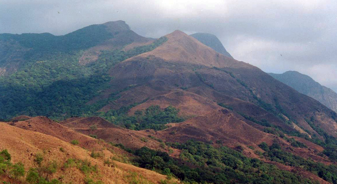
Kumara Parvatha, popularly known among trekkers as KP, is also called Pushpagiri, and it is the third tallest peak in Karnataka (based on the height from sea level). Mullayyanagiri and Kuduremukha, both in Chikmagalur District, take the first two spots. During 2003, I trekked to Kumara Parvatha. It is an imposing peak with thick shola forest cover on all sides.
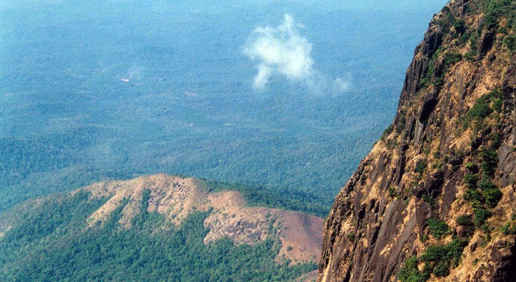
Kukke Subrahmanya is a famous pilgrimage place known for the temple of Bhagawan Subramanya. The majestic structure of KP looms large behind the temple from a very far distance. The trek actually starts from a by-lane near the temple itself. After about a kilometer of treading on a mud road, the path deviates and takes off into the forest. From here on, it is a nearly 4 hours uphill walk to a place called Girigadde. This stretch is quite boring, with absolutely no open view. The forest is monotonous and offers no excitement.
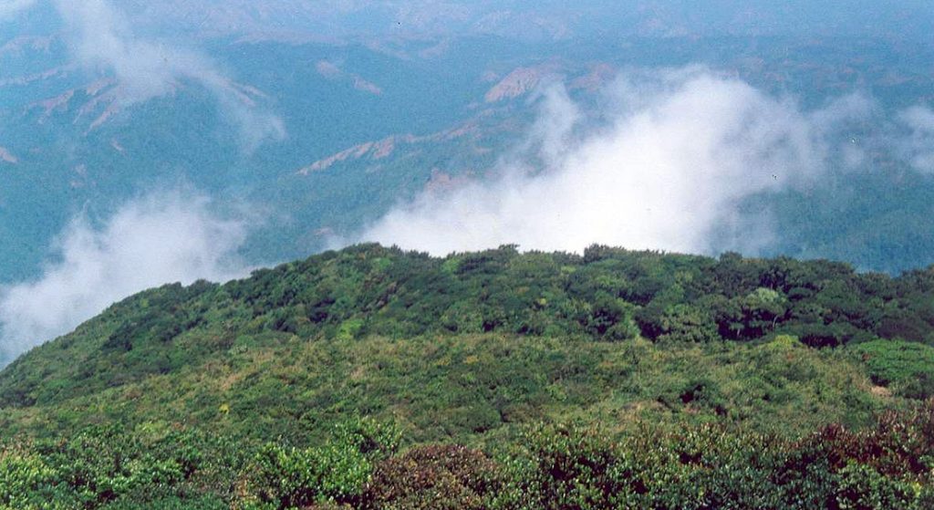
About a kilometer before Girigadde, the path breaks free from the forest and makes its way into open land. Now with the boring forest behind me, I really started to enjoy the trek from this point onwards. Though the rest of my fellow trekkers were already at Girigadde House (Mr. Bhat lives in this single house at Girigadde), I really slowed down a lot after the forest cover was over. It was a great view all around.
It was about 6 p.m. when I reached Girigadde House. 5 hours of long and winding paths! Our plan was to stay at this house for the night and continue toward the peak early the next morning.
Mr. Bhat offers food and shelter to the trekkers. Some call it a great service. But I plainly saw it as a business. He does charge a lot for food, and hence it can not be called service. Fair enough, trekkers get a place to rest and quench the thirst and hunger, but at a good price! There’s nothing wrong with it. I somehow just could not think beyond seeing it as a “business.”
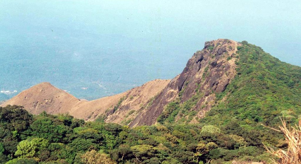
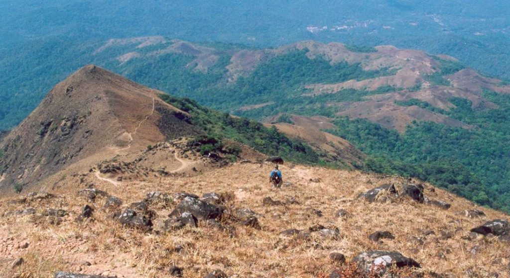
Early in the morning, at about 6, we were off towards the peak. On the way, there are 2 main sub-peaks to be crossed, known as “Bhattada Raashi” and “Shesha Parvatha.” The trail goes uphill soon in this open land with no tree cover, and that is why trekkers start early from Girigadde so as to reach the peak before midday. On the way up, at a turn, there is a four pillar mantapa, which offers shade and is a resting point. From Girigadde to Bhattada Raashi peak, this mantapa is the only source of shade, with not a single patch of forest or tree cover.
After the mantapa, it is a brisk climb towards Bhattada Raashi, and soon I reach there. The depth on the right thick forest cover and on the left it was forest again on the mountain itself. There is a ridge that starts immediately after the Bhattada Raashi peak towards Shesha Parvatha peak. This exciting ridge walk was the best experience of the whole trek. It is a short distance from Bhattada Raashi to Shesha Parvata, but I took some time to reach it, not because I was tired but because I walked slowly on the ridge to enjoy the view and the walk. The view from Shesha Parvatha is better than Bhattada Raashi.

From Shesha Parvata, the path leads down into a shoal (rain) forest and ends face to face with a large rock face measuring up to 75 feet in height. This rock face is the last point of the climb after which the trekker steps on the summit of KP. During rains, this rock face turns into a waterfall, because it is the only way down for the rain water splashing the summit of KP. A small amount of water was trickling down the rock face, but it was of no concern, and we could easily scale it and step on the summit. It was 10 a.m. when I reached there. The trek is worth it. Except for the initial route until a kilometer before Girigadde, the rest of the trek path is awesome.
Kukke Subrahmanya is 105 kilometers from Managluru, 275 kilometers from Bengaluru, and 73 kilometers from Madikeri. Subrahmanya Road, 12 kilometers away, is the nearest rail station, and Mangaluru is the nearest airport.
Article and photos by Rajesh Naik
*The views expressed in the article are those of the writer alone. Chaloindiaworld.com does not own any responsibility in any form if there is any wrong representation of facts or places.
**The copyright of all the photos and text content of this article is owned exclusively and only by Rajesh Naik, the author of this article. No one else has any right to copy/publish/print/download any photo(s) or text content of this article, either in part or in full, and use them for personal, professional, or any other purpose. For any such usage, prior written consent from the author is a must.