

Kabbe Hills & Chomakundu Viewpoint – Coorg
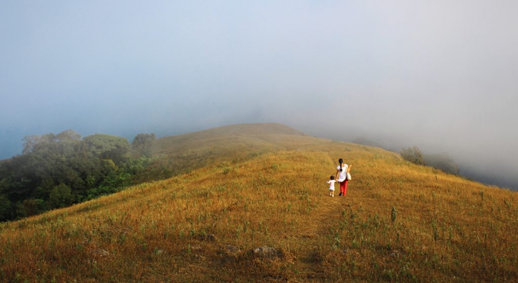
This time we had planned for the Kabbe Hill trek, a winter trek in Brahmagiri wildlife sanctuary. Early in the morning, the six of us, including my daughter, trooped into the car and were on our way. The winding drive began almost as soon as we left Madikeri city. Our drive would take us through narrow roads surrounded by coffee estates and forests. After a short drive, we reached the forest gate. We parked our vehicle, and soon after, we set foot on the trail.
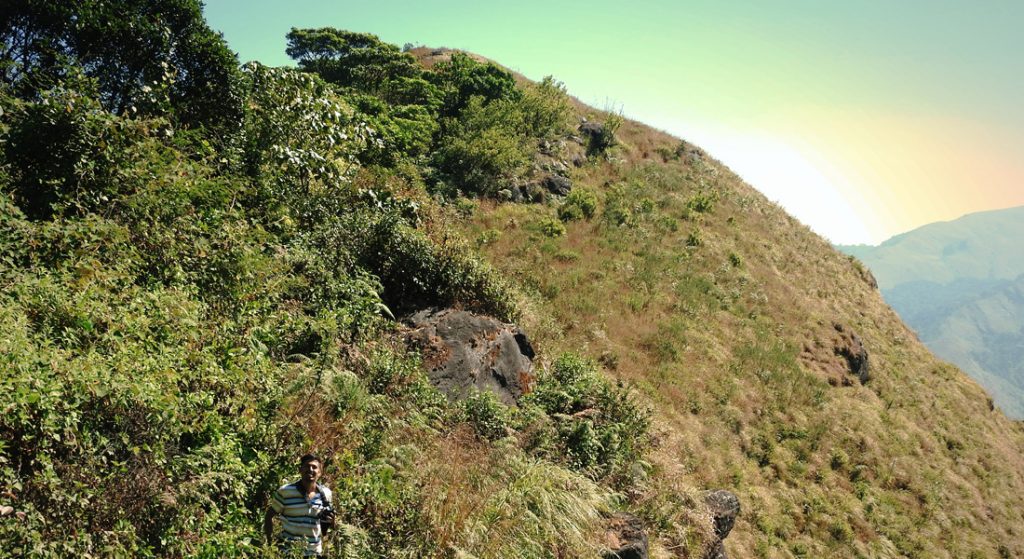
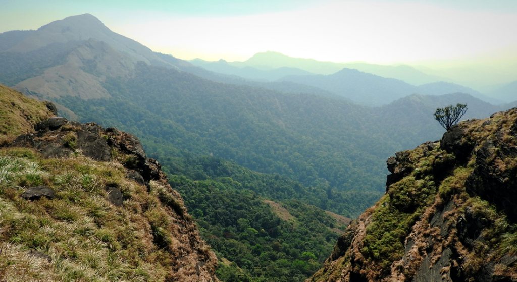
There is an old forest road that makes a detour towards Kabbe Hill. With the bare minimum of essentials, we started the hike. With the sounds of the flowing streams and chipping birds, along with the company of squirrels, we moved on to enjoying the thick bushes and forest growth. After about ten minutes, we reached a large, open grassland situated in a shallow valley between two hills. The first one-third of the trek was a gentle climb along the unevenly laid stone path. The weather was crystalline, sunny, and dry, and the views were breath-taking at every turn, so our enthusiasm soared.
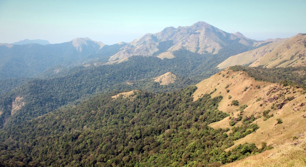
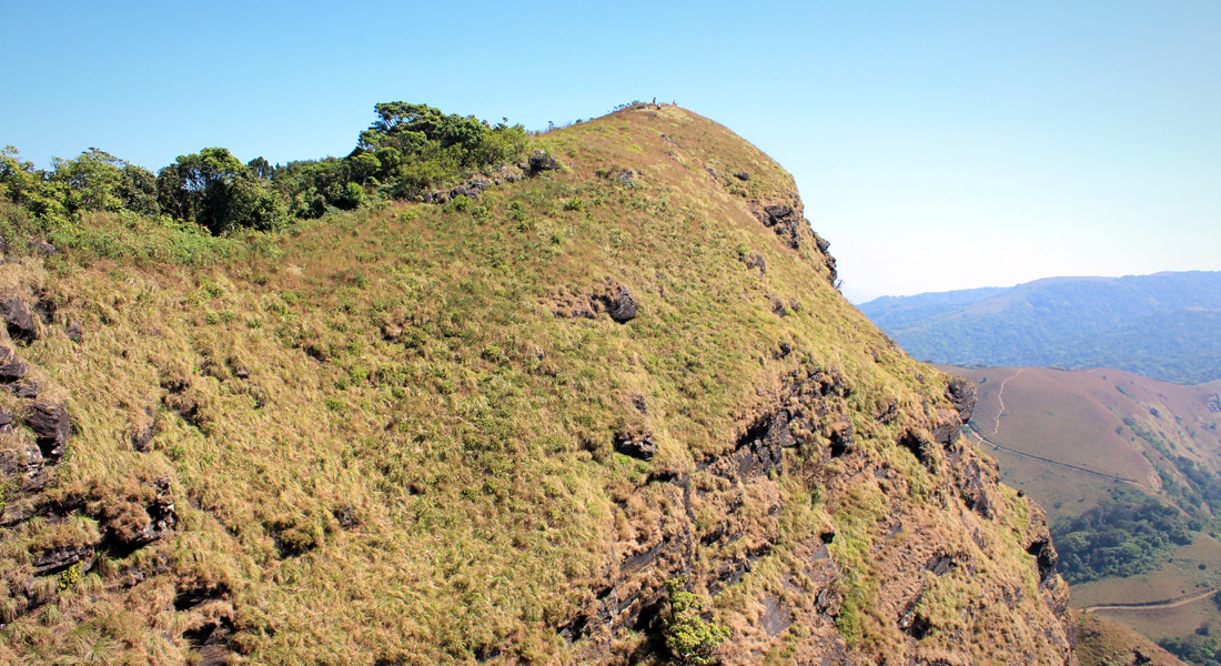
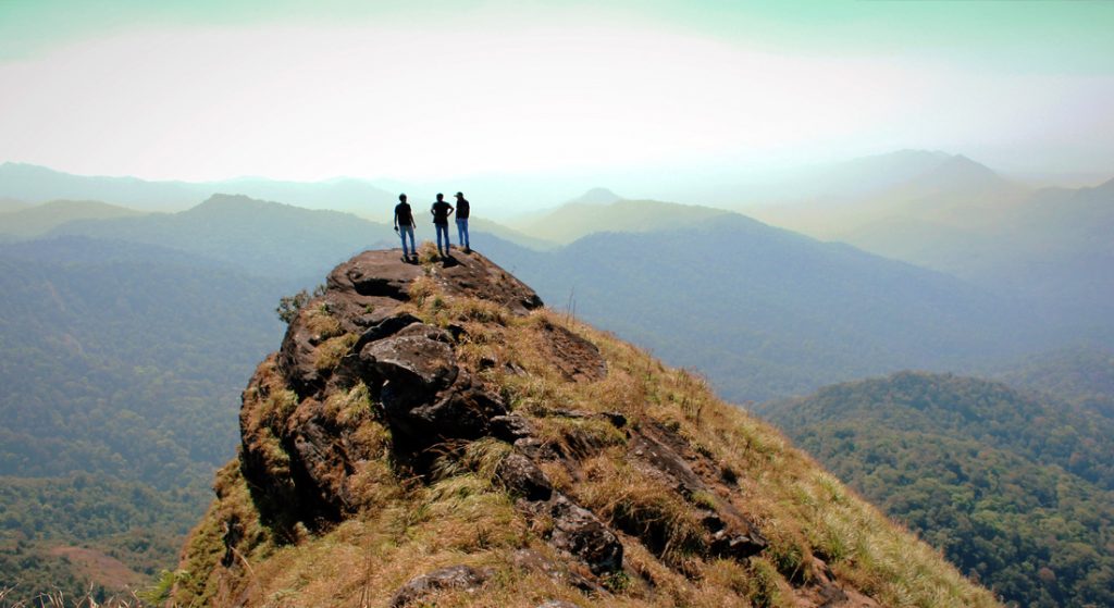
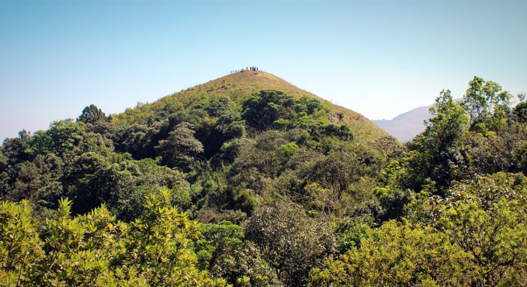
The next one-third of the trail was steeper but manageable. The stones were scattered about loosely, and there was no telling which one was firmly anchored, and which one would give way. We stepped gingerly, testing the stability of each stone, and moved on. The trail was a continuous ascent for about 30 minutes, and finally, we reached the summit. The 360-degree view left us speechless. The view that we were seeing was beyond any kind of imagination. It was time to soak up the bounty of nature and regain our strength. We sat on the summit and had two watermelons.
During my previous trek to this hill, fog covered the entire peak, so I had no clue how the views were. I was lucky this time that there was clear weather, and I could endlessly enjoy the spectacular view of the surrounding hills, valleys, grasslands, and forests.
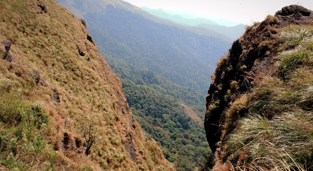
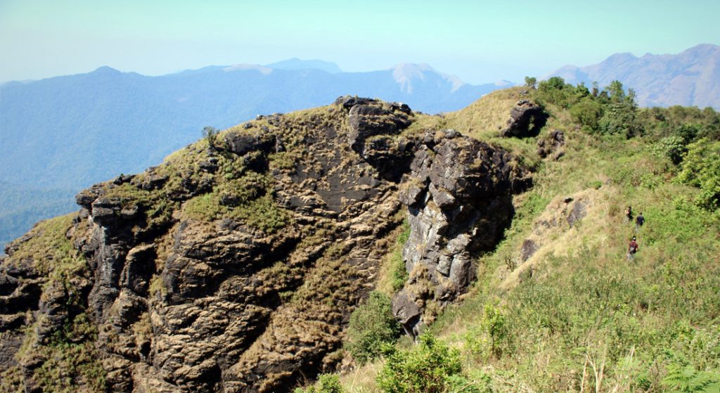
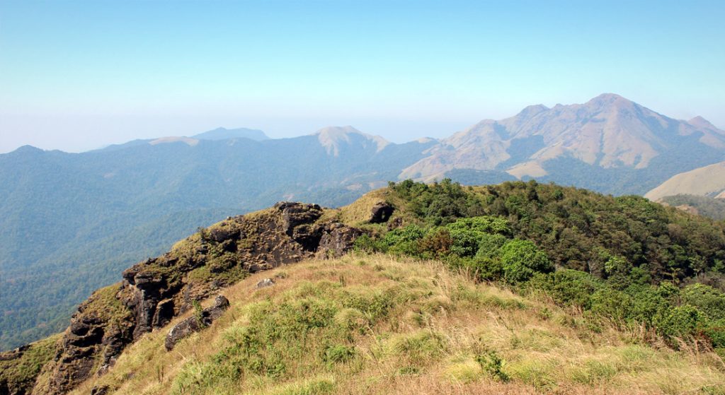
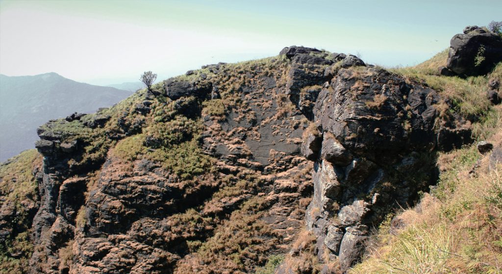
We took some photographs and headed towards the next hill. We kept going and soon entered the final one-third section of the trek, which was a gradual descent while walking on the ridge of the mountain toward our destination, a rocky hill. Thick foliage and spiky bushes made the path difficult to tread on. This was undoubtedly the best part of the trek. This is also a place to do some amateur rock climbing, as a pile of large boulders was the final hurdle toward the summit. We scrambled over these large boulders to step onto the summit.
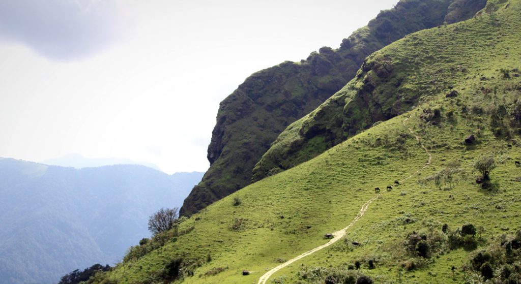
Now we were treated to views of the beautiful Udumbe forest valley as we looked towards the western edge of the hills, apart from the views of Bylikere Hill and Chomakundu Hill ranges. On clear days, the villages of Kerala are visible, which lie many miles to the west. The views were so good that it took some time for me to return to reality.
The descent, especially the second part, was a bit tougher than it was while ascending. One must be careful here, as a wrong step could cause serious injury. We took it one step at a time, walked slowly, and made it back to the old forest road.
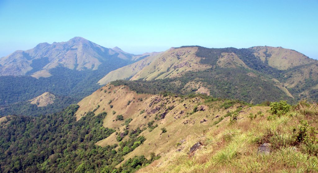
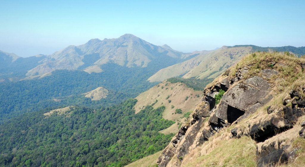
There is a small hill adjacent to the Kabbe Hills. Since there was plenty of time at our disposal, we decided to give it a shot and started climbing. We followed the forest road towards Kabbe Hill viewpoint, and in less than thirty minutes we were there. This place is also known as the First Stage of Chomakundu Hill. To reach Chomakundu Peak, we had to cross two more hills that towered in front of us. Chomakundu is also known as Choma Betta. The view of the Kabbe Hills, which we had ascended in the morning, was something to cherish. It was a surreal feeling to imagine that we had successfully climbed to the top of such a beautiful hill.
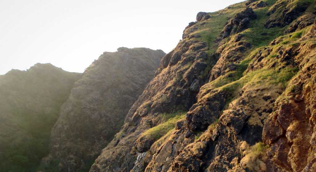
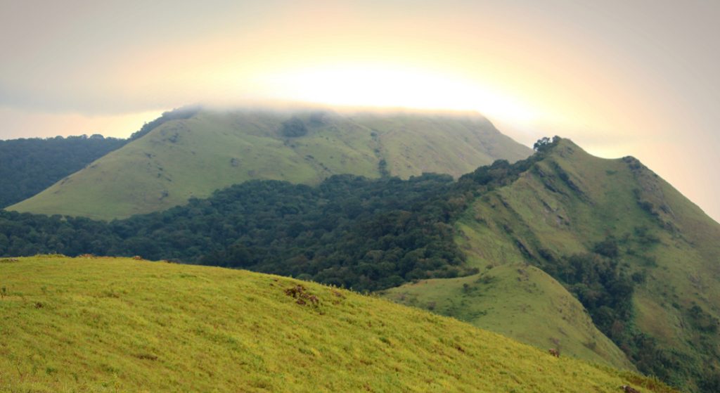
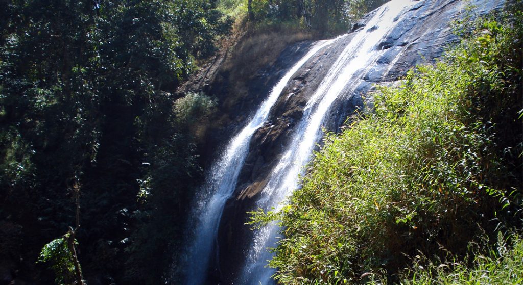
On one side, Kabbe Hill presented a surreal view; on the other, Choma Betta presented a great view in front of us. We could see a few tourists atop Kabbe Hill. Soon enough, the fog came in, and a bit later, dark clouds appeared on the horizon and indicated that it was time to leave. The way down from the Chomakundu viewpoint was quite slippery, and we all slipped and fell down at least once. As we neared the parking lot, we visited Haluholey Falls and the famous Chelavara Falls before returning home.
The hike to Kabbe Hills starts from the Chelavara Falls, located at Nariyanda village, 32 kilometres from Madikeri. The waterfall is 3 kilometres from Nariyanda.
Article and Photos: Rakesh Holla
*The views expressed in the article are those of the writer alone. Chaloindiaworld.com does not own any responsibility in any form if there is any wrong representation of facts or places.